Images of southeastern Manitoba
Part 6
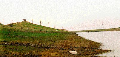 Down-hill skiing in Manitoba: An artificial ski hill (Springfield Hill)
built on the bank of the Red River Floodway just northeast of Winnipeg.
This picture, taken on May 26, 1996, shows the lower part of the ski lift
submerged under the water when the Floodway was used to divert
water from downtown Winnipeg during extensive spring floods.
Down-hill skiing in Manitoba: An artificial ski hill (Springfield Hill)
built on the bank of the Red River Floodway just northeast of Winnipeg.
This picture, taken on May 26, 1996, shows the lower part of the ski lift
submerged under the water when the Floodway was used to divert
water from downtown Winnipeg during extensive spring floods.
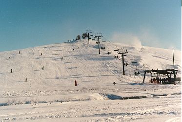 And this picture taken on Nov. 24 of the same year (from
a place that was under the water in the pictue above) shows the
Springfield ski hill already in full winter operation.
And this picture taken on Nov. 24 of the same year (from
a place that was under the water in the pictue above) shows the
Springfield ski hill already in full winter operation.
There are also somewhat higher natural skill hills in Manitoba
near the Falcon Lake on the Ontario border in the East and in,
and south of, the Riding Mountain National Park in the West (see
the next picture), but the Springfield hill
is easily accessible to Winnipeg kids.
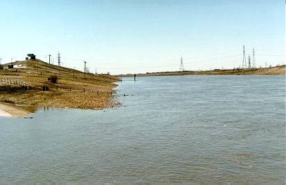 And this is the same place on May 3, 1997 at the height of the
Red River Flood of the Century.
And this is the same place on May 3, 1997 at the height of the
Red River Flood of the Century.
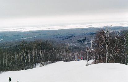 View from Mt. Agassiz in the Riding Mountain National Park
of the snow covered plains far below in the East
(Jan. 18, 1997).
View from Mt. Agassiz in the Riding Mountain National Park
of the snow covered plains far below in the East
(Jan. 18, 1997).


