|
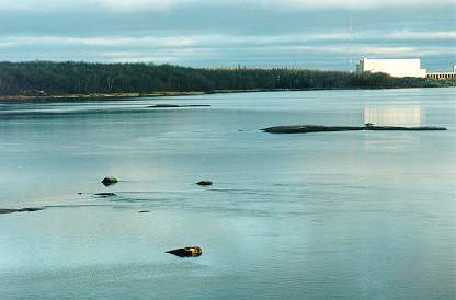
| This telephoto has already appeared here twice. Some distances in it are rather shortened. For example, to swim with the current from the more distant islet on the left (in the south outside the area on my map) to the closer one on the right (that is the one from the map; both are about 20 m long) took me about 20 minutes (I have not tried to do that against the current, I am afraid that would take me infinitely long). The rocks in the foreground are those rather small rocks, about half a meter in diameter, near point 3. They were just a few meters in front of my camera. |
|---|
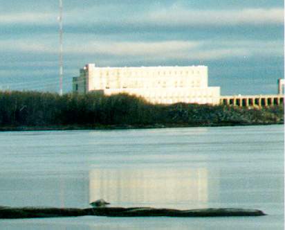
When I cut from the above picture electronically the area around the power station, and magnified it, I got the lower picture which shows surprisingly many details including half of the dam.
|
For example, only after inspecting this blow-up, did I find that the transmission
lines to the left of the station are also faintly visible on the paper original of the above picture.
It is quite interesting how such a rather high dam could be built in an at first sight completely flat landscape. It was possible because the river flows here in sort of a very shallow canyon. |
|
|---|
When looking from the top of the dam towards the Pinawa bridge, the river just below the dam reminds a large oval shaped pool full of pinkish granite rocks and boulders of quizzical shapes. These are sometimes fully exposed, and in other times completely submerged in water. Directly below the dam on the left is an oblong rock which, with a little bit of fantasy, can transform into a huge crocodile in your eyes. If there is surplus water falling over the top of the dam, it crashes onto the crocodile. If there is a lot of surplus water, the crocodile is completely hidden underneath. In winter, the crocodile can be covered by meters thick layer of frozen water mist of fantastic shapes.
