A few more winter pictures from around the Pinawa bridge
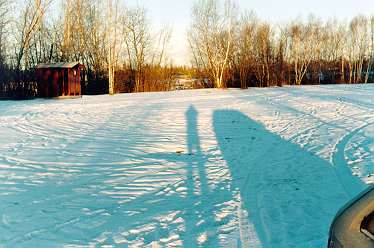
| This is a picture made on November 26, 1997 when, unlike this year, everything had been well covered by snow by then. It shows how long are the shadows cast onto the Pinawa Bridge Wayside by the low morning winter sun. |
|
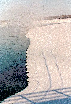
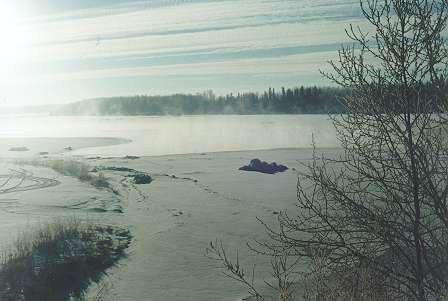
| This photo from February 1995 shows the fractal edge of the ice cover of the frozen area of the river north of the bridge, and also the vapour rising from the river on especially cold days, which can cover the trees along the river with thick layers of hoarfrost, and in the end convert them into fairy formations. For the river to freeze completely over in this place, the temperature must stay around -30°C for many days. |
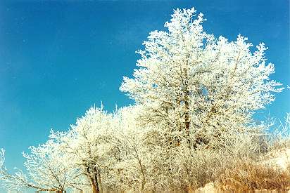
| And here is an example of such hoarfrost on the trees where beavers were so busy logging this past fall below the Pinawa Bridge Wayside. January 26, 1999. |
|
|
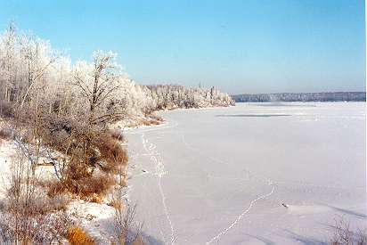
More hoarfrost on the trees on the west bank of the Winnipeg River. And a mesh of wildlife trails on the frozen river. January 26, 1999. |
|---|
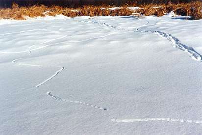
| More trails on the bottom of the fourth abandoned beaver lake (two pages back): A mouse trail on the left, disappearing several times under the snow, crossing a deer trail on the right. The mouse trail might originally have been a tunnel just below the surface of the snow all along. Later the "roof" of the tunnel might have collapsed along most of its length. January 26, 1999. |
|
|---|
|
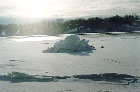
This is another close-up view of the ice-capped rock from the "Swimming and gnawing beavers page". Never before in the previous five winters did such formations occur here. This winter, they appeared around Christmas when the temperature suddenly plunged below -20°C, which caused a rapid creation of big chunks of ice everywhere on the surface. These chunks of ice then piled around the rocks in the river, and only after that was most of the river surface covered with a continuous sheet of ice. January 25, 1999. |
|---|
| And once again the view from the bridge of the same ice pile (on the right) and the area denoted by Nos. 3 and 5 on the map (on the left). January 26, 1999. |
|
|---|

